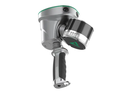
CHCNAV RS7 Slam Scanner
The CHCNAV RS7 is a high-performance handheld LiDAR SLAM scanner designed for fast, accurate indoor and outdoor reality capture. Combining advanced LiDAR, high-precision INS + SLAM technology, and HD imaging, the RS7 produces dense, colorized point clouds with an efficient field-to-office workflow.
- Up to 1.15 million points per second for fast, high-density data capture.
- 360° × 189° field of view captures floors, walls, and ceilings in a single pass.
- INS + SLAM technology delivers reliable mapping in GNSS-denied environments like buildings, tunnels, and corridors.
- Dual HD cameras create realistic, colorized point clouds and detailed 3D models.
- Cloud-ready workflow with CHCNAV CoCloud enables one-click uploads, automated processing, and rapid project delivery
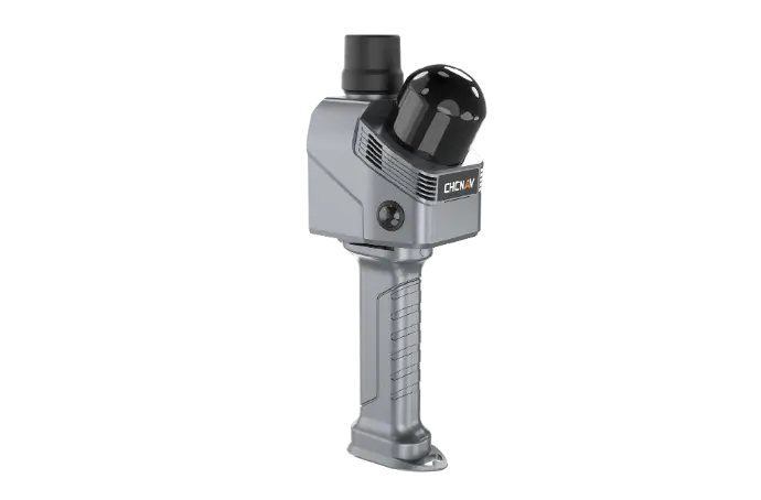
GeoCue Trueview GO
The GeoCue TrueView GO is a professional handheld LiDAR mapping system built for rapid indoor and outdoor reality capture. By combining survey-grade LiDAR, GNSS RTK/PPK, Visual SLAM, and LP360 software, it delivers a complete field-to-finish workflow for creating accurate digital twins and point clouds.
- Survey-grade LiDAR with GNSS RTK/PPK + Visual SLAM for accurate mapping, even in GNSS-denied environments.
- Available in 16-channel (116S) and 32-channel (132S) models to match a variety of project requirements.
- Three integrated 5 MP RGB cameras create detailed, colorized point clouds and digital twins.
- Live point cloud preview on the included tablet ensures complete data coverage before leaving the jobsite.
- Seamlessly integrates with LP360 for processing, QA/QC, classification, and deliverable creation in one software platform.