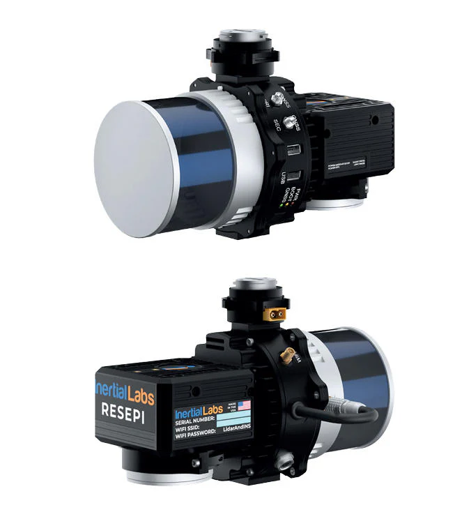
RESEPI XT32 LiDAR System
The RESEPI XT32 LiDAR System (no camera) is a powerful, standalone LiDAR solution designed for high-precision 3D mapping and surveying applications. Featuring 32 laser channels, the XT32 generates dense and accurate point cloud data, ideal for applications such as topographic surveys, forestry, infrastructure inspection, and asset management.
This system excludes a camera, offering users the flexibility to collect only LiDAR data or to pair it with an external imaging system if desired. The XT32 delivers excellent range, resolution, and performance in complex environments, capturing detailed spatial information even in challenging conditions.
Compact and lightweight, the XT32 LiDAR System is compatible with drones, vehicles, and handheld devices, allowing for versatile deployment across a range of field applications. Built for rugged outdoor use, it provides reliable, high-quality data collection tailored to the needs of professional surveyors, engineers, and geospatial specialists.